Khao Nang Yong
| Description | Details |
| Trail Name: | Khao Nang Yong |
| Trail Location: | Rayong |
| Trail Type: | Single track |
| Trail Difficulty: | Moderate |
Rayong offers plenty in the way of opportunities for mountain biking, thanks to an active group of cyclists who have spent their time creating trails throughout the province. There are numerous hill ranges between 300-600m in elevation which despite being popular amongst locals, are little known by people outside of Rayong other than trails which host various events such as Khao Yai Da.
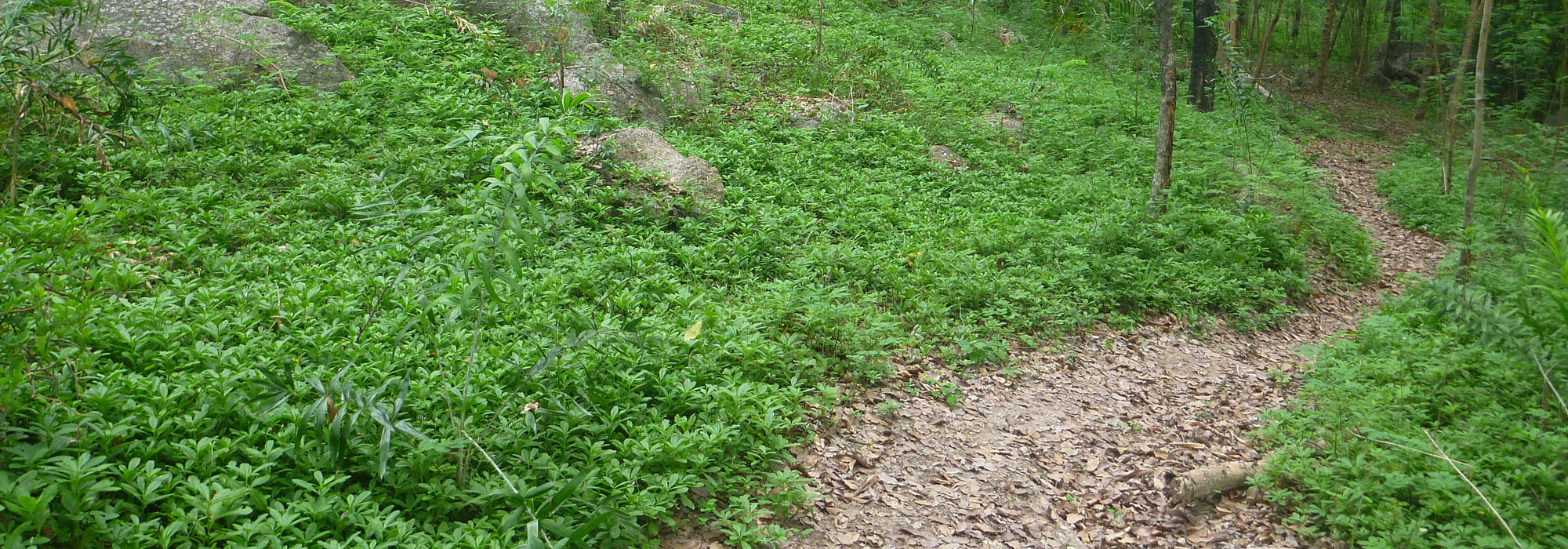
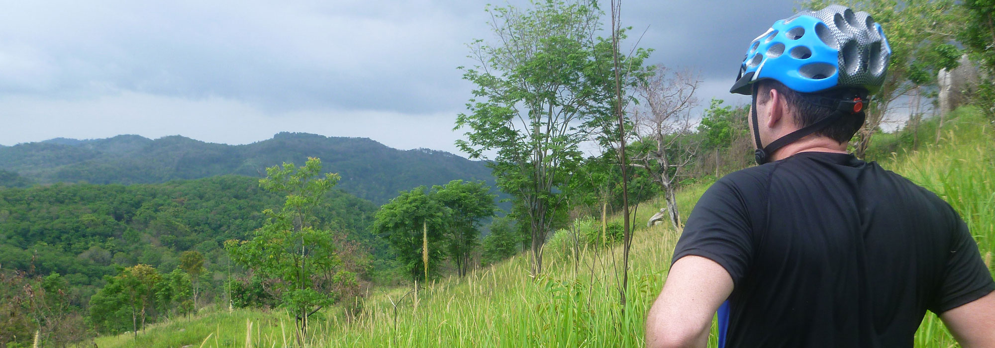
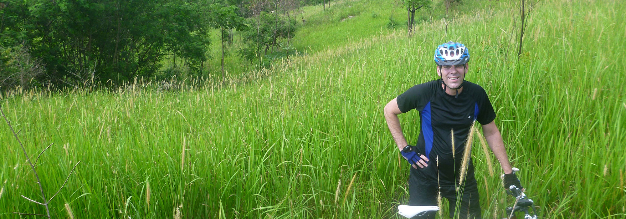
An interesting trail lies just 30 minutes drive from Pattaya and 2 hours drive from Bangkok, and is located around a group of hills visible from the main road heading into Rayong. The highest hill is called Khao Nang Yong, which despite being just 400m in height, can form part of a tough trail with plenty to challenge mountain bikers. Mountain biking on Khao Nang Yong can be a fun experience and the views are worth the trip. Depending on where you start, the trail can consist of dirt roads, single track, rocky stream beds, jungle, farm trails and a grassy area near the summit with fantastic views of the surrounding area. Once near the summit there is not much cover from trees so take plenty of water and suncream. There are enough trails to keep MTB riders occupied for several repeat trips and for golfing fans there are also a couple of courses in the area for anyone looking for alternative activities.
The area is popular with motor bikers and so some parts of the trail are badly eroded in places, however the majority of the trail is in good condition. Getting to the trail can be tricky, there are MTB signs around St Andrews Country Club however they seem to lead to no-where. The GPS coordinates on this page will get you going on the main trail, but there are plenty of alternative routes to explore if you just head into the hills. Once on the main trail there area number sign posts to point you in the right direction.
Directions
From Bangkok or Pattaya to get to Rayong you will take Highway 7 and turn off onto Highway 36 leading to Rayong. Head down Highway 36 for about 16km and you will see the mountains on the right, before you reach them take the 3376 road past St Andrews. Drive just past St Andrews and take a small lane marked Huai Mahat on Google, followed by Huai Mahat 3/2. Note that roads marked on Google are often dirt trails, which may be tough to navigate in the wet season for small cars.