Chiang Dao Cycling Trails
| Description | Details |
| Trail Name: | Mae Na to Mae Taeng |
| Trail Location: | Mae Na, Chiang Dao |
| Trail Type: | XC / Downhill |
| Trail Difficulty: | Moderate |
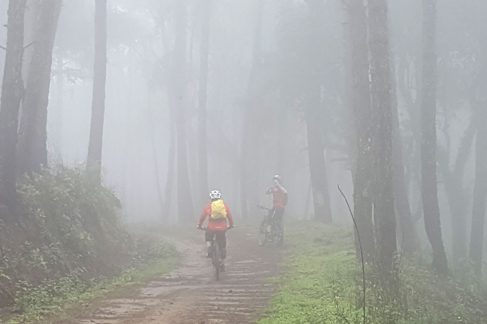
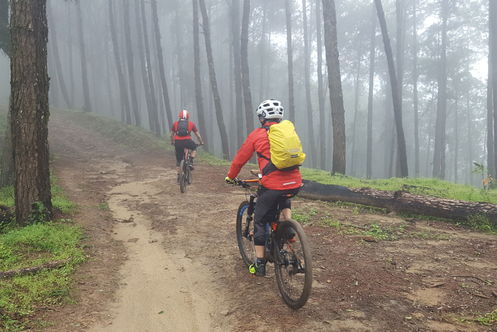
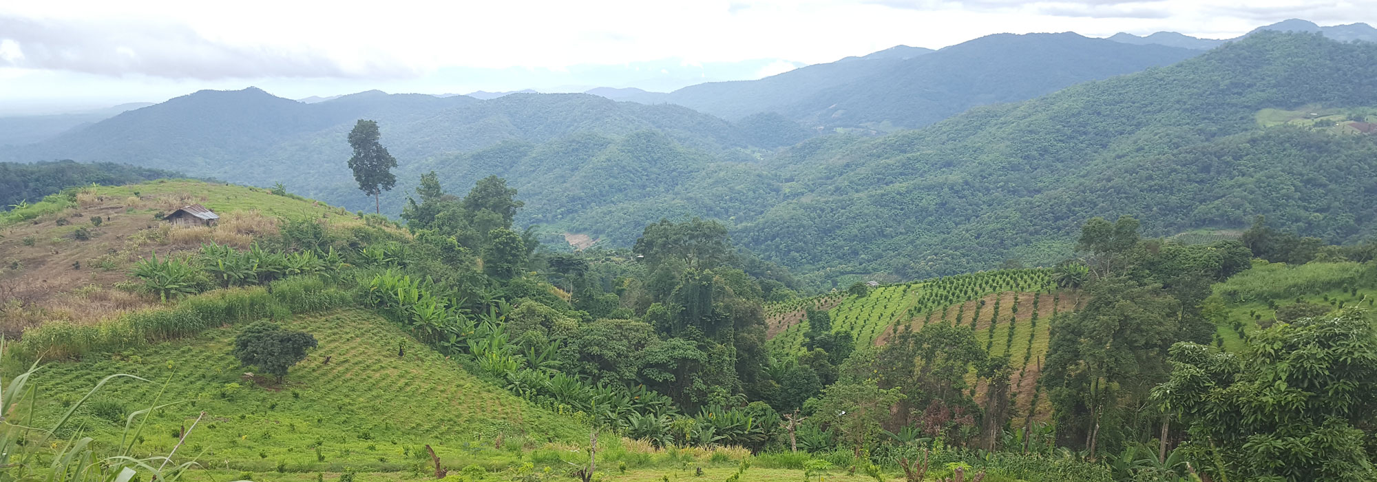
For a bit of effort, this Mae Na cycling trail will reward mountain bikers with stunning scenery, flowy single track and double track and interesting temples and villages set among the jungle and mountains. This trail starts in Tambon Mae Na, a district just south of Doi Luang Chiang Dao and starts at an altitude of 1500m / 4921ft at a campsite which can be found on Google if you type in Kaset Thi Sung MO Cho Office.
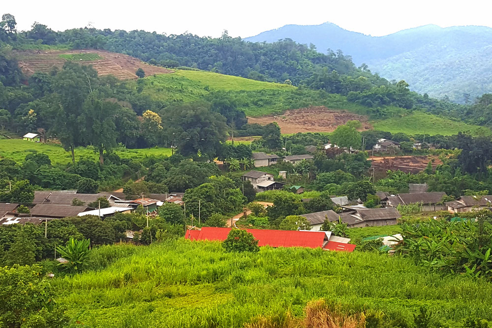
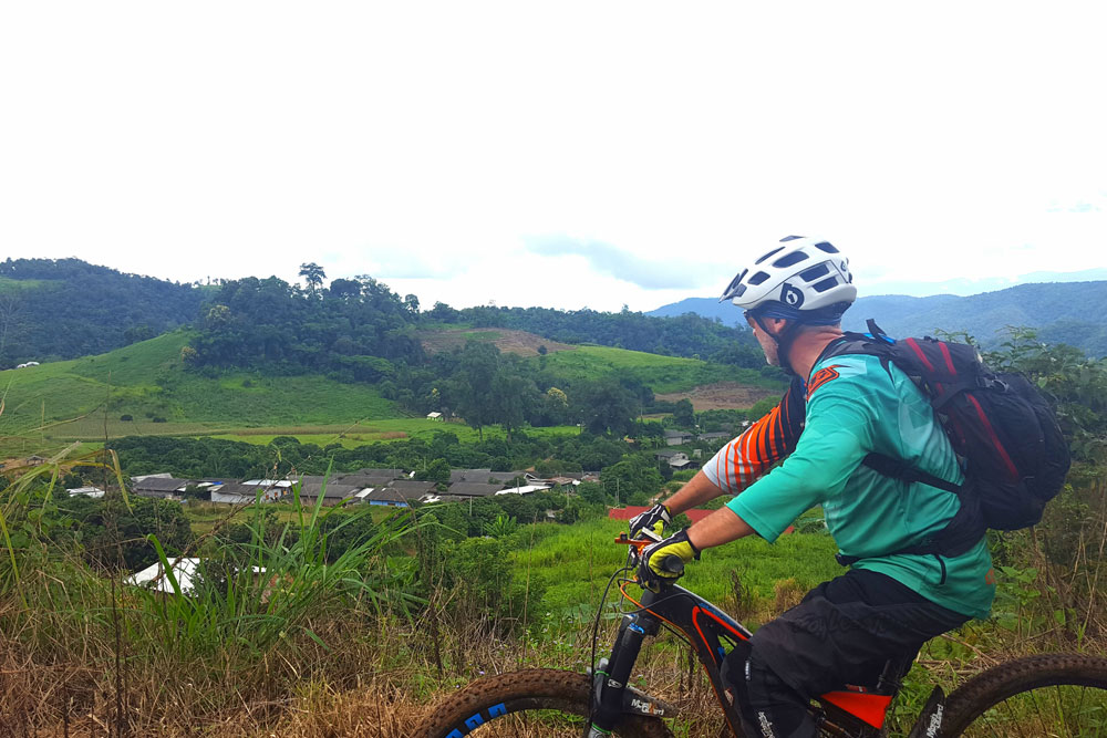
To get to the trailhead, take the 107 highway North out of Chiang Mai for approximately 1 hour until you reach Chiang Dao district. Pay careful attention as you drive through the village of Pa Kia as the road is very narrow but its just before a 7-11. The GPS coordinates are 19.3289601,98.9544151. From here the going gets a bit tough and you will need a 4×4 to climb the mountain as much of the road is dirt trail and in bad condition, especially in the raining season. The views from the top are breath taking and on a clear day there are fantastic views of Doi Luang Chiang Dao.
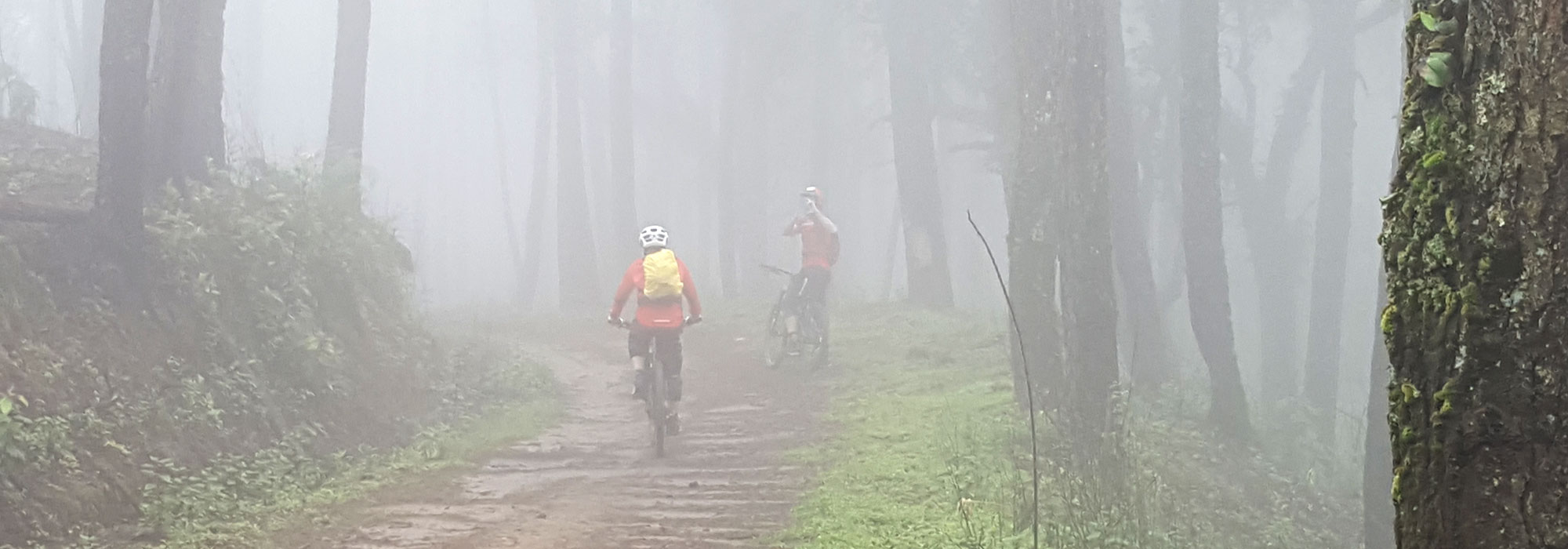
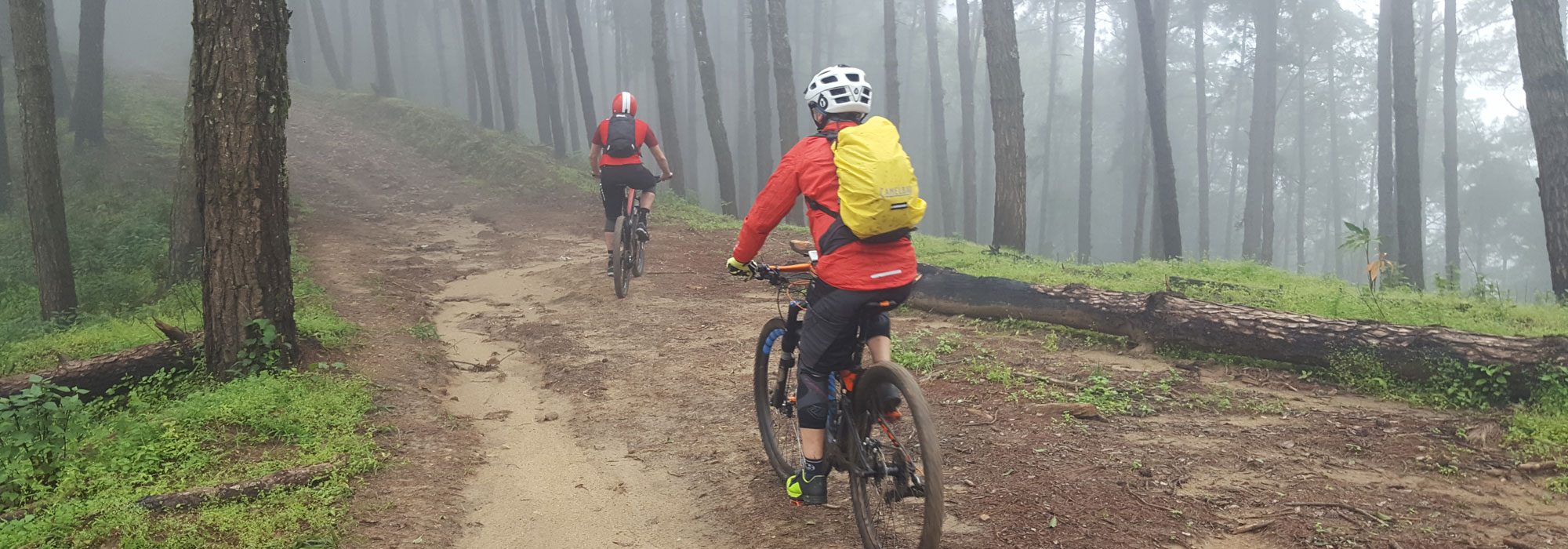
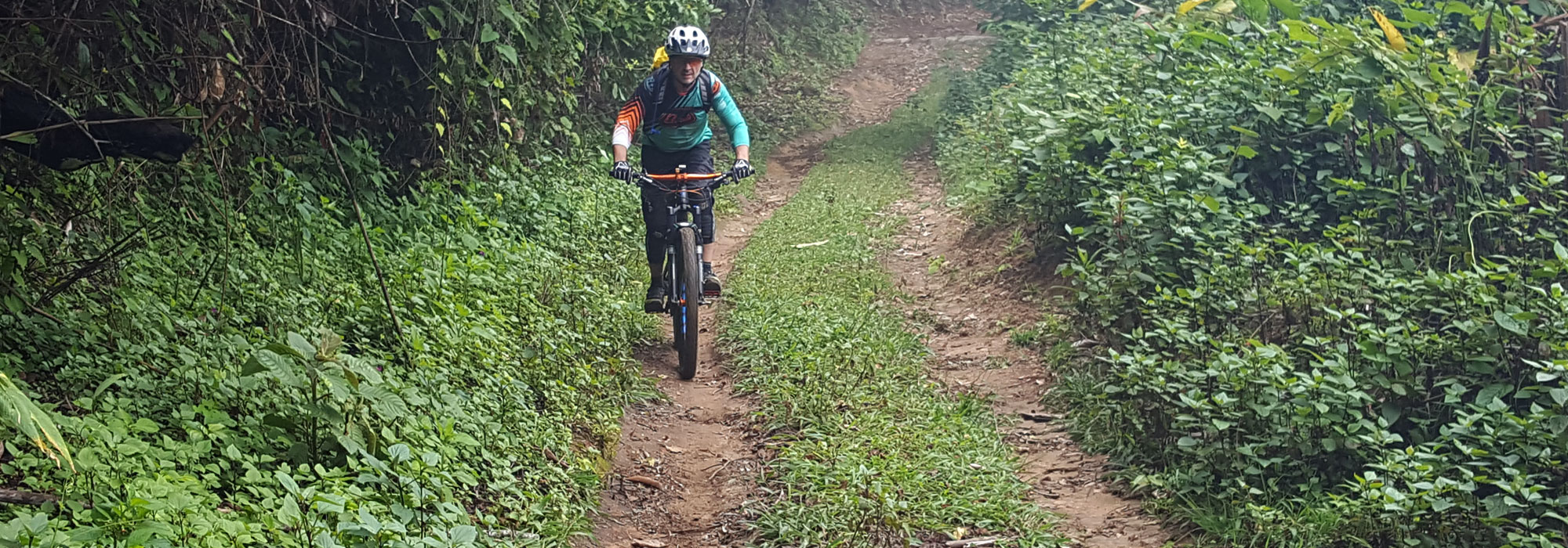
The Mae Na cycling trail follows the mountain ridge south west through evergreen forest for several kilometers before dropping into the valley towards Mae Taeng. The first section has several assents and descents, totaling 400m / 1300ft of gain however after this it is downhill all the way into Mae Taeng. The terrain consists mainly of double track with some flowy smooth sections towards the top and more technical single track with rock gardens towards the bottom as you reach the Hmong village. From the Hmong village it is paved for several kilometers to the end of the trail which is opposite Maetaman elephant camp in the Mae Taeng valley.